GNSS-independent UAV navigation
Problem
UAV positioning can become unreliable when satellite navigation is blocked, degraded or deliberately disrupted. Visual observations must then be related to georeferenced map evidence despite changes in altitude, season, route and geography.
Why it matters
A dependable visual backup can support safer autonomous flight and mission continuity in GNSS-denied and GNSS-degraded environments.
Approach
- Nadir UAV imagery matched with satellite imagery and orthophotos
- Autoencoder-based representation learning and deep neural networks
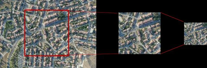
- Template matching and cross-view localization
- Terrain-referenced altitude labelling with EXIF and DEM data
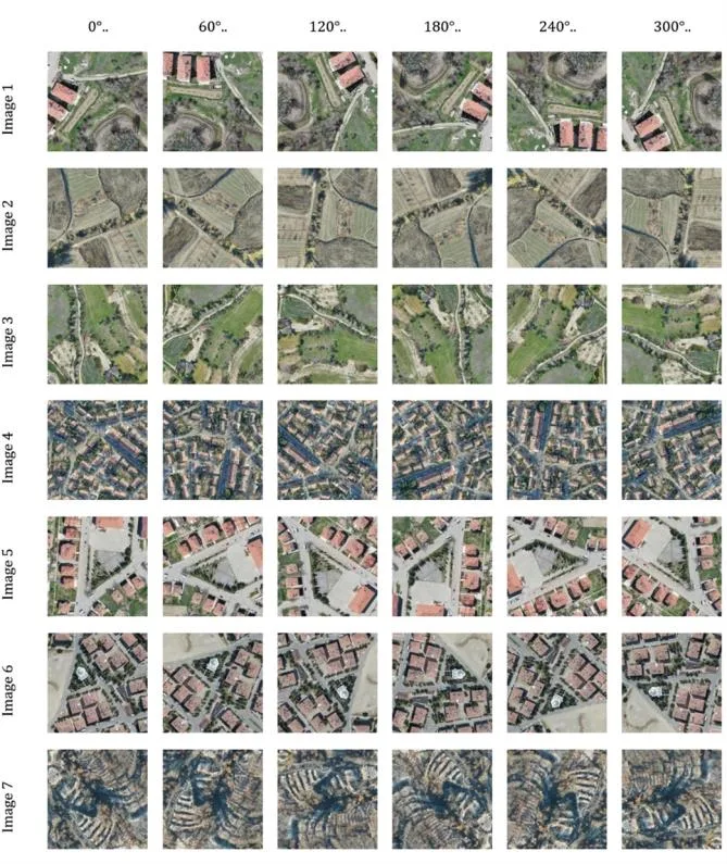
- Generalization tests across urban, rural, seasonal and route conditions
Evidence
- The approved 2024 doctoral thesis documents autoencoder and template-matching experiments for terrain-based UAV localization.
- The 2026 peer-reviewed altitude study evaluates a ResNet50 regression model on 303,710 real nadir images.
- Conference records document GNSS-denied localization and vision-based altitude-estimation outputs presented in 2025.
Selected outputs
Publications
- Location Detection of Unmanned Aerial Vehicles with Terrain-Based Navigation Using Autoencoder Deep Neural Network
- GNSS-Denied Navigation: Autoencoder-Based Deep Neural Network for UAV Localization
- A Vision-Based Deep Learning Approach to UAV Altitude Estimation
- Vision-based UAV Altitude Estimation using Deep Learning: A ResNet50 Approach on Nadir Images
Projects
- Terrain-Based UAV Positioning Using Autoencoder Deep Neural Networks
- Vision-Based UAV Altitude Estimation with Deep Learning (external link)
Current direction
Improve robustness across terrain and flight conditions, examine higher-resolution elevation models and connect altitude estimation with broader terrain-relative navigation.